Monday, December 12, 2011

Register for the NS Hiking & Snowshoeing Summit Jan. 28

Hike Nova Scotia invites individuals and groups with an interest in hiking, walking and snowshoeing to the first annual Nova Scotia Hiking & Snowshoeing Summit.

This one-day event will take place on Saturday, January 28, 2012 at Kejimkujik National Park and National Historic Site in Maitland Bridge.

The Summit is a celebration of Nova Scotia 's hiking culture, which includes sharing best practices, stories and networking opportunities. It will help us grow a hiking, walking and snowshoeing culture in the province. Space is limited, so register early to reserve your spot.

Check out the Summit flyer for a draft agenda, registration link, directions and more here: http://tiny.cc/pn05f.

Friday, October 14, 2011

Hiking Trails of Nova Scotia Videos

While I am hiking I take many pictures, sometimes more than 100 on a particularly scenic trail. And on most trails I also take a short video, usually of between 30 sec. to one minute. I have been fortunate to visit some exceptionally beautiful locations, and for many of the trails I worry it might be the final time I will be able to hike them.

I have decided to post some of my videos - or who knows, maybe eventually all of them - on You Tube. Each video will be titled, "Hiking Trails of Nova Scotia", which will be followed by the trail's name. I am posting these under the name "hikerhaynes".


Not every trail is exciting or especially scenic, so neither are their videos. You might wonder why I have posted some those less dramatic films, but what you see will in every case be a fair representation of what you will encounter along the trail. And sometimes that is just a quiet walk through the forest - but that is ok too. Hope you enjoy whatever you view, and that it might inspire you to chose to hike a little more often.

Thursday, September 22, 2011

Fall around the corner - Great Hiking!

Although the end of summer can never be celebrated in a country like Canada, where the winters too often seem endless, nevertheless fall is the time of year that many hikers consider the best time to be exploring. True, the days are much shorter, but by the end of October there are still more than 10 hours of daylight - usually enough for any hike. And although temperatures at night may fall below freezing, during the day, especially in September, temperatures rise above 15 - very comfortable.

So I wish to make a few suggestions for some great fall hiking in the HRM.

Coastal hiking is always wonderful along the Atlantic coastline near Halifax, and I could suggest any number of options. However, for those who might only have time for an afternoon's outing, or wish for a short walk, I suggest you consider Polly's Cove on the St. Margaret's Bay peninsula. This 3 km informal footpath meanders along the shoreline in the coastal barrens near more well-known Peggy's Cove. If the ocean is calm you may walk along the exposed rocks at water level; if it is stormy, you can stay on the tops of the granite ridges. [pg. 147-149]

Those looking for an east stroll where they may view the changing colour of the leaves might consider a visit to Dollar Lake Provincial Park, nestled in the interior of the HRM near the Halifax Airport. With the end of summer the park's gates are closed where it connects with Highway 212. As a result, an 8 km walk may be had by following the park's access roads from the highway to the picnic grounds and the camping areas. Along the way, you will pass through hillsides covered predominantly by hardwoods, and have access to the lakeside. [pg. 129-131]

And for those who would prefer a more rugged trek, the Admiral Lake loop near Musquodoboit Harbour should both exercise your legs and please your eyes. Starting and ending with a gentle stroll along a former railbed, this trail provides a middle passage filled with steep hills, commanding views, and rugged footing. At 10 km in length, with more than 5 km of backcountry footpath, you will probably need at least three hours to complete it. However, you will probably be more than satisfied that whatever effort was required was worthwhile. [pg. 71-74]

But whatever type of outdoor experience you enjoy - except, maybe, sunbathing - this is the best time of year for it. Enjoy!

Monday, August 8, 2011

Error Found - Old Annapolis Road

Well folks, it looks as if the first confirmed error in Trails of Halifax Regional Municipality has been found and communicated to me through this blog. It looks as if I made a huge mistake in the GPS coordinates for the Old Annapolis Road. Somehow, instead of its own latitude and longitude, I repeated those of the Charles MacDonald Sportspark - a considerable distance away!

Please accept my apologies; the error was mine in the writing and proof-reading phase of the book preparation.

The correct coordinates for the start of the Old Annapolis Road route are: N44° 45” 08.4’ N63° 56” 01.5’.

My thanks go to Tim Peach, who sent me notice of this on August 7, 2011.

Tuesday, June 14, 2011

Short Summer Coastal Walk - Pennant Point

Good weather has been scarce this spring, but that only makes us appreciate even more the few days that have been sunny and warm. Sometimes, in coastal Canada, the window of opportunity - the time between when the fog lifts and the when next storm rolls in - is measured in only hours. When the weather is like this, if we want to venture outdoors we need something a hike where we can drive in minutes, not hours.

Let me introduce you to Pennant Point: A slender finger of granite extending into the Atlantic Ocean, located near the mouth of Halifax Harbour close to the picturesque village of Sambro, Pennant Point features sandy beaches, a short managed trail, an extended coastal back country track - and it is barely a 30 minute drive from the Armdale Rotary on Highway 349.

A popular recreation spot for decades, the beach area is more well known as Crystal Crescent Beach, and is a provincial park. Most of the remainder of Pennant Point has been incorporated into the Terence Bay Wilderness Protected Area, and is protected from further development. A few pockets of private property remain, but most are close to the small community of East Pennant.

Long before I hiked anywhere else in the province, I walked the coastline at Pennant Point. This area enjoys so much: a gleaming white sand beach, rugged and rocky coastline, magnificent coastal scenery, and a sense of isolation and wilderness remarkable in an area so close to the city.

In Trails of Halifax Regional Municipality I profile only the developed trail from the parking area, behind the beaches, until it ends at the rocks bordering the small nude beach at Mackeral Cove. However, for those who do not mind wet feet and a little scrambling over granite rocks, an informal footpath continues along the rugged coastline to the very tip of Pennant Point. I could gush about the scenery, which has always captivated and inspired me, but I will leave you to discover that for yourself.

So this summer, whenever - if ever - the clouds part for a few hours and you feel the urge to venture outdoors, head for Pennant Point. Maybe, like me, you will discover a place that will draw you back for the rest of your life. And maybe even go when it is cloudy. The scenery is still affecting.

Monday, May 2, 2011

Hike Nova Scotia Annual Meeting & Hike: May 15

The Hike NS Annual General Meeting will be held at the Shearwater Aviation Museum in Dartmouth on Sunday, May 15.

A guided hike will be held beforehand at 10 am on the nearby Shearwater Flyer Trail, at noon a free lunch will be provided for those who RSVP (info@hikenovascotia.ca) and at 1 pm the AGM will begin.

Find details and directions here: Hike NS AGM Flyer

I will see you there.

Monday, March 14, 2011

Spring Hike - Admiral Lake Loop

As spring arrives in Nova Scotia - rarely quickly - hiking can become somewhat of a challenge. Most of the terrain near Halifax is made up of granite and other protruding rocks with a thin layer of soil, usually found in bogs, barely covering them. With the snow mostly melted, those convenient snowshoes have to be stored away, but the ground is not dry enough yet for easy walking.

Nevertheless, I do not think you should not avoid all trails at this time of year. After all, with the warmer weather will also come black flies and mosquitoes, and although walking will be drier and easier, there will be those other, off-setting problems. Instead, for avid hikers consider selecting one of the more challenging trails, away from the coast with its cold winds and frequent April rains squalls, for your weekend walk.

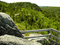
I recommend the Admiral Lake loop, which features a jaunt to the edge of the Whites Lake Wilderness Protected area. This rugged 10-km loop, which climbs several granite hills, begins and ends in the village of Musquodoboit Harbour on the abandoned rail line. Hikers have the choice of warming up along this gentle path for 1.8 or 2.5 km before turning into the vegetation to their right and beginning their trek.

If the section along the rail-line was too easy, what you face once you leave it is anything but. From either of the two access points to the loop, you enter into a work of jumbled rocks and steeply climbing hillsides. There are so many rocks here, that I often think that one come hop from one to the next for the entire length of the trail, and never need to touch dirt.

But for those who enjoy a grunt over rough terrain, this is just fine!

And you will be rewarded for your effort. The Admiral Lake Loop features numerous, striking look-offs. There are picturesque views of the Musquodoboit River Valley, of Admiral Lake, and of the surrounding granite uplands. Not only that, but other interesting attractions, such as "The Cave" await discovery. (And admit it, doesn't the chance to see "Skull Rock" excite your sense of adventure just a little?)

The Admiral Lake Loop in not suitable for everyone. Even those who consider themselves fairly fit should allow extra time to complete this trail. However, I think that once you complete it, it will become one of your favourite hikes available within the HRM, and a suitable choice for a spring-like April scramble.

Tuesday, January 18, 2011

No Corrections - or Comments - Yet Received

Happy New Year everyone. I hope that you getting outdoors and not permitting the winter weather to keep you housebound. (I did a 15km run at -25 [wind chill] Sunday morning with the Ottawa Orienteering Club. The hardcore added another 5km through unploughed forest trails.)

One of the reasons I established this blog was to provide updates to the routes that I have profiled in Trails of Halifax Regional Municipality. Some might think that unnecessary, especially when the book was only published in July 2010, but you might be surprised how often something changes, even on a popular managed trail. Bridges wash out, facilities are added, and forest fires occasionally shut trails. So, with the aid of comments submitted to this blog, I thought that I might be able to update readers on any variations on the ground from what is presented in the book.

However, to this point nobody has commented on any changes that they might have noticed. It is possible that I made no mistakes in the book (and anyone who has written a guidebook will know that this is impossible), or that they have yet to be submitted. I am guessing it is the later, so I would like to remind everyone that if they notice something different on the trail from what I wrote in the book, please make a comment on any story on the blog. I will review it and post it for the benefit of all other users of Trails of Halifax Regional Municipality.

Enjoy your snowshoeing and cross-country skiing.